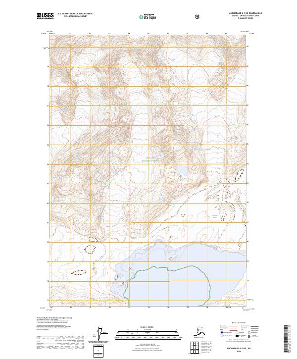
2023 Map of Anchorage A-1 NE
USGS Topo · Published 2023About this map
Chugach National Forest land defines the wilderness landscape of this Chugach Census Area quadrangle. This 2023 survey documents a remote coastal and glacial environment where the Columbia Glacier meets the northern waters. The map provides precise topographic detail of the ice-carved terrain, showing the complex interaction between land and glacial ice as it stood at the start of the 2020s. Without roads or settlements, the map focuses on the physical geography and public land boundaries, including parts of t7s r11w, t7s r10w, t8s r11w, and t8s r10w. It serves as a modern baseline for understanding the scale of the glacier and the vast forest territory in this part of Alaska.
Find a feature on this map
6 named features on this map. Tap any name to fly to it.
Don’t see what you’re looking for? This feature index may not catch every label — zoom into the map to look around manually.
Map Details
Editions of this 2023 Anchorage A-1 NE Map
This is the sole edition of this map. No revisions or reprints were ever made.
Other maps of this area

1951 · Anchorage
USGS Topo · 1:250,000

1952 · Valdez
USGS Topo · 1:250,000

1960 · Valdez A-8
USGS Topo · 1:63,360

1960 · Anchorage A-1
USGS Topo · 1:63,360

1960 · Anchorage B-1
USGS Topo · 1:63,360

1960 · Valdez B-8
USGS Topo · 1:63,360

1960 · Valdez
USGS Topo · 1:250,000

1962 · Anchorage
USGS Topo · 1:250,000

1979 · Anchorage
USGS Topo · 1:250,000
1995 · Valdez A-8
USGS Topo · 1:63,360