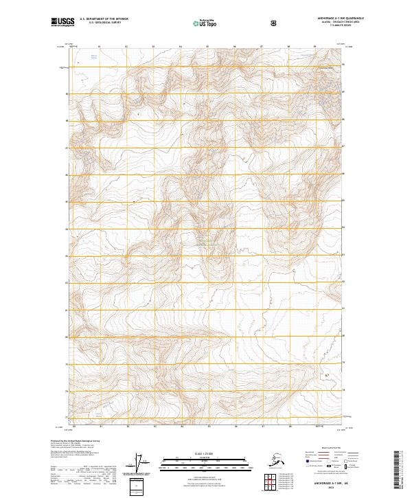
2023 Map of Anchorage A-1 NW
USGS Topo · Published 2023About this map
Chugach National Forest encompasses the vast majority of this landscape in the Chugach Census Area of Alaska. The terrain is defined by massive ice fields and drainage systems, notably the Columbia Glacier and the adjacent Meares Glacier at the northern edge. At the northeastern corner, Columbia Peak serves as a prominent high point above the moving ice. To the south, the Pedro Glacier feeds into the headwaters of the Miners River, illustrating the high-altitude hydrologic connections typical of the coastal ranges. This 2023 survey provides precise modern contours and land status boundaries for this glaciated wilderness, showing the extent of the forest reservation and the complex interplay of ice and stone.
Find a feature on this map
10 named features on this map. Tap any name to fly to it.
Don’t see what you’re looking for? This feature index may not catch every label — zoom into the map to look around manually.
Map Details
Editions of this 2023 Anchorage A-1 NW Map
This is the sole edition of this map. No revisions or reprints were ever made.
Other maps of this area

1951 · Anchorage
USGS Topo · 1:250,000

1960 · Anchorage A-2
USGS Topo · 1:63,360

1960 · Anchorage A-1
USGS Topo · 1:63,360

1960 · Anchorage B-1
USGS Topo · 1:63,360

1960 · Anchorage B-2
USGS Topo · 1:63,360

1962 · Anchorage
USGS Topo · 1:250,000

1979 · Anchorage
USGS Topo · 1:250,000
1995 · Anchorage A-1
USGS Topo · 1:63,360
2013 · Anchorage A-2 NE
USGS Topo · 1:25,000
2013 · Anchorage B-1 SW
USGS Topo · 1:25,000