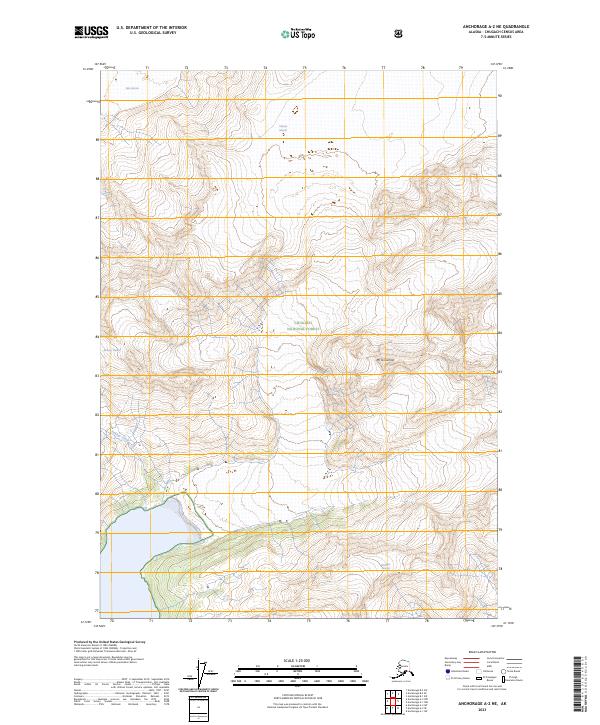
2023 Map of Anchorage A-2 NE
USGS Topo · Published 2023About this map
Chugach National Forest dominates this Alaskan landscape, where the ice-dominated terrain of the Chugach Mountains is documented in high detail. The map centers on the high-altitude topography surrounding Mt Grosvenor, a prominent peak situated among several major glacial systems. To the northwest, the Yale Glacier descends from high ridgelines, while the Meares Glacier and Ranney Glacier carve through the deep valleys of the central and western portions of the quadrangle. The meltwater from these massive ice fields feeds into Ranney Creek, illustrating the complex drainage patterns of the Chugach Range. Further south, the Brilliant Glacier marks the edge of this glacial wilderness. This 2023 survey provides a clear view of contemporary ice extent and terminal positions, offering a vital reference for those tracking the changing geography of Alaska's coastal mountain ranges.
Find a feature on this map
11 named features on this map. Tap any name to fly to it.
Don’t see what you’re looking for? This feature index may not catch every label — zoom into the map to look around manually.
Map Details
Editions of this 2023 Anchorage A-2 NE Map
This is the sole edition of this map. No revisions or reprints were ever made.
Other maps of this area

1951 · Anchorage
USGS Topo · 1:250,000

1960 · Anchorage A-2
USGS Topo · 1:63,360

1960 · Anchorage A-1
USGS Topo · 1:63,360

1960 · Anchorage B-1
USGS Topo · 1:63,360

1960 · Anchorage B-2
USGS Topo · 1:63,360

1962 · Anchorage
USGS Topo · 1:250,000

1979 · Anchorage
USGS Topo · 1:250,000
1995 · Anchorage A-1
USGS Topo · 1:63,360

2013 · Anchorage B-2 SW
USGS Topo · 1:25,000
2013 · Anchorage A-2 NE
USGS Topo · 1:25,000