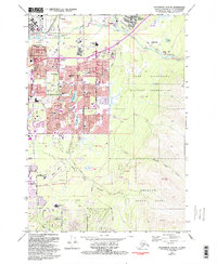
1979 Map of Anchorage A-8 NE
USGS Topo · Published 1993About this map
Elmendorf Air Force Base and the Fort Richardson Military Reservation dominate the northern and eastern portions of this late 20th-century landscape, illustrating the critical role of military infrastructure in the growth of Anchorage. The map reveals a dense suburban network expanding eastward from the city center, marked by a high concentration of neighborhood schools like Ptarmigan Sch and Wonder Park Sch. This residential development is punctuated by significant green spaces and recreational areas, including the expansive Far North Bicentennial Park and Chugach State Park. The drainage patterns of Ship Creek and Chester Creek contrast with the grid of major thoroughfares such as Boniface Parkway and Tudor Road, reflecting the tension between the region's natural hydrology and its rapid urban footprint during the 1970s and 1980s.
Find a feature on this map
64 named features on this map. Tap any name to fly to it.
Don’t see what you’re looking for? This feature index may not catch every label — zoom into the map to look around manually.
Map Details
Editions of this 1979 Anchorage A-8 NE Map
3 editions found
Other maps of this area

1951 · Anchorage
USGS Topo · 1:250,000

1952 · Anchorage A-8
USGS Topo · 1:63,360

1952 · Anchorage B-8
USGS Topo · 1:63,360

1953 · Anchorage A-8
USGS Topo · 1:63,360

1953 · Anchorage B-8
USGS Topo · 1:63,360

1960 · Anchorage B-7
USGS Topo · 1:63,360

1960 · Anchorage A-7
USGS Topo · 1:63,360

1962 · Anchorage
USGS Topo · 1:250,000

1965 · Anchorage B-8
USGS Topo · 1:63,360

1979 · Anchorage B-7 SW
USGS Topo · 1:25,000