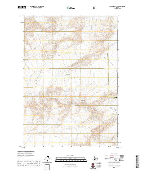
2023 Map of Anchorage B-1 SW
USGS Topo · Published 2023About this map
Glacial flows and high peaks dominate this part of the Chugach National Forest, illustrating the massive ice fields at the boundary of the Chugach Census Area. The landscape is defined by the convergence of several major ice systems, including the Harvard Glacier and Yale Glacier, which carve through the high elevations of the Chugach Mountains. Notable summits such as Mt Glenn, Mt Cardozo, and Mt Michelson rise between these frozen rivers, providing fixed points in an environment of shifting ice and snow. The map further documents the Columbia Glacier and Meares Glacier, offering a detailed view of the terrain within the Township and Range system near the edge of the Copper River region.
Find a feature on this map
15 named features on this map. Tap any name to fly to it.
Don’t see what you’re looking for? This feature index may not catch every label — zoom into the map to look around manually.
Map Details
Editions of this 2023 Anchorage B-1 SW Map
This is the sole edition of this map. No revisions or reprints were ever made.
Other maps of this area

1951 · Anchorage
USGS Topo · 1:250,000

1960 · Anchorage A-2
USGS Topo · 1:63,360

1960 · Anchorage A-1
USGS Topo · 1:63,360

1960 · Anchorage B-1
USGS Topo · 1:63,360

1960 · Anchorage B-2
USGS Topo · 1:63,360

1962 · Anchorage
USGS Topo · 1:250,000

1979 · Anchorage
USGS Topo · 1:250,000
1995 · Anchorage A-1
USGS Topo · 1:63,360
2013 · Anchorage B-2 NE
USGS Topo · 1:25,000
2013 · Anchorage A-2 NE
USGS Topo · 1:25,000