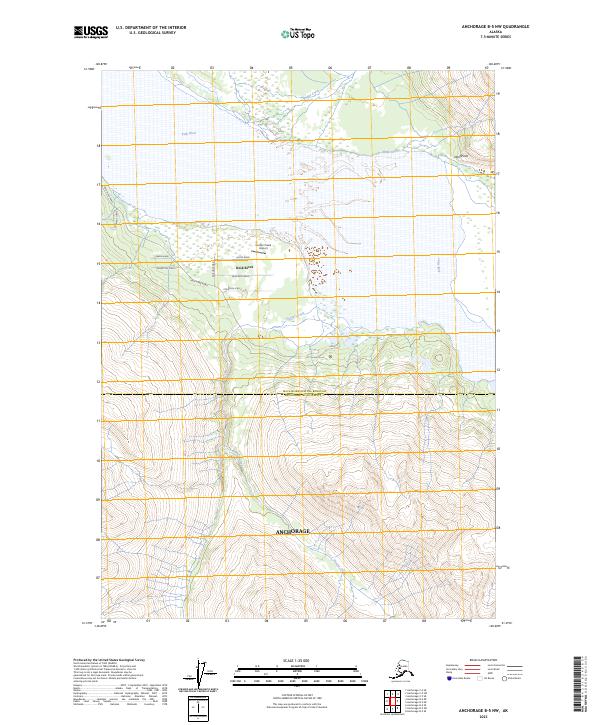
2023 Map of Anchorage B-5 NW
USGS Topo · Published 2023About this map
Knik River dominates the northern reaches of this Alaskan landscape where the river’s wide, braided channels meet the wetlands of the Matanuska-Susitna Borough Anchorage Municipality border. The settlement of Knik River is characterized by a concentrated network of residential roads, including Justin Road, Ed Rush Road, and Phoenicia Circle, centered near the Hunter Creek Airport. This small aviation hub serves a community situated between the river’s edge and the rising elevation of the surrounding terrain.
Find a feature on this map
21 named features on this map. Tap any name to fly to it.
Don’t see what you’re looking for? This feature index may not catch every label — zoom into the map to look around manually.
Map Details
Editions of this 2023 Anchorage B-5 NW Map
This is the sole edition of this map. No revisions or reprints were ever made.
Other maps of this area

1951 · Anchorage
USGS Topo · 1:250,000

1951 · Anchorage C-6
USGS Topo · 1:63,360

1951 · Anchorage C-5
USGS Topo · 1:63,360

1952 · Anchorage C-5
USGS Topo · 1:63,360

1960 · Anchorage B-6
USGS Topo · 1:63,360

1960 · Anchorage C-5
USGS Topo · 1:63,360

1960 · Anchorage B-5
USGS Topo · 1:63,360

1962 · Anchorage
USGS Topo · 1:250,000
1979 · Anchorage C-6 SE
USGS Topo · 1:25,000

1979 · Anchorage
USGS Topo · 1:250,000