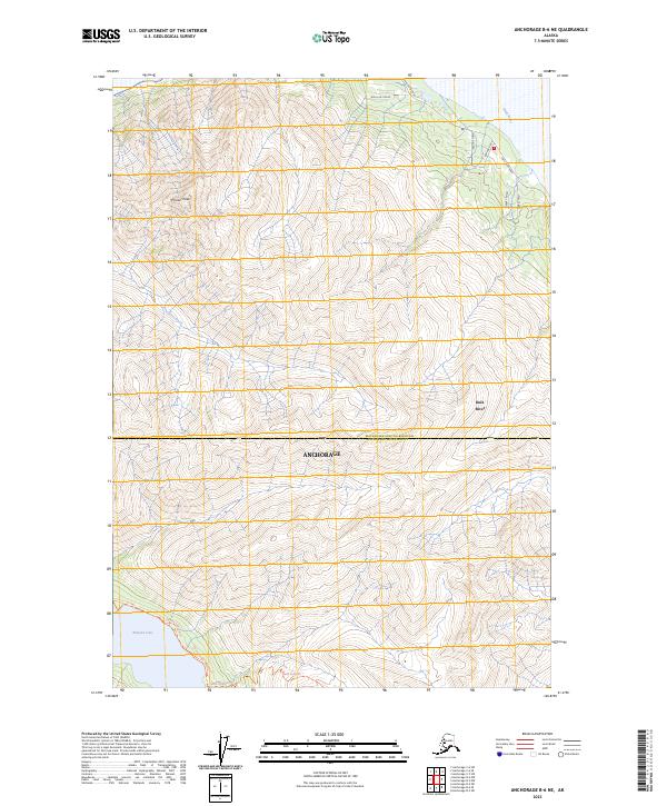
2023 Map of Anchorage B-6 NE
USGS Topo · Published 2023About this map
Pioneer Peak dominates the northern interior of this Alaskan landscape, where the Matanuska-Susitna Borough Anchorage Municipality line bisects a terrain of sharp elevation changes. The southwestern corner is anchored by the glacial waters of Eklutna Lake, with access provided by the Eklutna Lower Lakeside Trl and Eklutna Lakeside Trl. To the northeast, the Knik River cuts through the lowlands, bordered by a concentrated network of residential roads including Knik River Road and Sherry Road. The transition from the steep ascent of Bold Ridge Trl to the river flats illustrates the dramatic topography typical of the Chugach Mountains interface, showing how modern access routes like Birch Hill Drive navigate the difficult geography near Anchorage.
Find a feature on this map
19 named features on this map. Tap any name to fly to it.
Don’t see what you’re looking for? This feature index may not catch every label — zoom into the map to look around manually.
Map Details
Editions of this 2023 Anchorage B-6 NE Map
This is the sole edition of this map. No revisions or reprints were ever made.
Other maps of this area

1951 · Anchorage
USGS Topo · 1:250,000

1951 · Anchorage C-6
USGS Topo · 1:63,360

1951 · Anchorage C-5
USGS Topo · 1:63,360

1952 · Anchorage C-5
USGS Topo · 1:63,360

1960 · Anchorage B-6
USGS Topo · 1:63,360

1960 · Anchorage C-5
USGS Topo · 1:63,360

1960 · Anchorage B-5
USGS Topo · 1:63,360

1962 · Anchorage
USGS Topo · 1:250,000

1979 · Anchorage B-6 NW
USGS Topo · 1:25,000
1979 · Anchorage C-6 SE
USGS Topo · 1:25,000