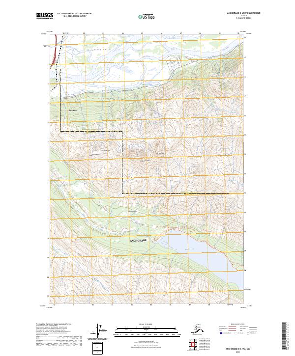
2023 Map of Anchorage B-6 NW
USGS Topo · Published 2023About this map
The Matanuska Valley convergence of the Matanuska River and Knik River dominates this modern landscape where the Matanuska-Susitna and Anchorage county line traverses the high peaks. The terrain is marked by significant commemorative landmarks, including Mt POW/MIA and Gold Star Peak, standing as prominent sentinels over the drainage basins of Goat Creek and Thunder Bird Creek. To the south, the waters of Eklutna Lake are accessible via a network of developed paths such as the Eklutna Lakeside Trl and the Eklutna Lake Spillway Trl. This area reflects the modern recreational and commemorative geography of the region, where infrastructure like the Knik River Access Road and Eklutna Lake Road provides a gateway into the alpine wilderness from the surrounding Anchorage vicinity.
Find a feature on this map
32 named features on this map. Tap any name to fly to it.
Don’t see what you’re looking for? This feature index may not catch every label — zoom into the map to look around manually.
Map Details
Editions of this 2023 Anchorage B-6 NW Map
This is the sole edition of this map. No revisions or reprints were ever made.
Other maps of this area

1950 · Anchorage C-7
USGS Topo · 1:63,360

1951 · Anchorage
USGS Topo · 1:250,000

1951 · Anchorage C-6
USGS Topo · 1:63,360

1951 · Anchorage C-7
USGS Topo · 1:63,360

1952 · Anchorage C-7
USGS Topo · 1:63,360

1960 · Anchorage B-7
USGS Topo · 1:63,360

1960 · Anchorage B-6
USGS Topo · 1:63,360

1962 · Anchorage
USGS Topo · 1:250,000

1979 · Anchorage B-6 NW
USGS Topo · 1:25,000
1979 · Anchorage B-7 SE
USGS Topo · 1:25,000