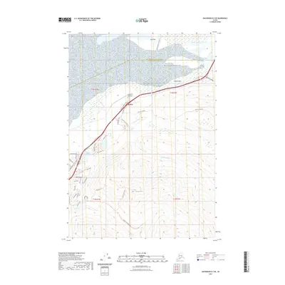
2021 Map of Anchorage B-7 NE
USGS Topo · Published 2021About this map
The settlement of Eklutna serves as the focal point of this coastal and mountain landscape, where the Matanuska Valley meets the waters of the Eklutna Flats and Duck Flats. Historical continuity is evident at the Saint Nicholas Orthodox Church Cem, a site of deep significance for the local community and genealogy. The transport network reveals a layered history, featuring the modern Glenn Highway corridor alongside the Iditarod National Historic Trl, which traces a path through the lowlands north of the massive rising slopes of Mt Eklutna. To the south, recreational and residential development is visible around Mirror Lake and the scenic Thunder Bird Falls, connected by a network of local roads such as Reese Road and Paradis Lane. This area represents a vital intersection of native heritage, early twentieth-century trail routes, and contemporary suburban growth within the Anchorage Municipality.
Find a feature on this map
51 named features on this map. Tap any name to fly to it.
Don’t see what you’re looking for? This feature index may not catch every label — zoom into the map to look around manually.
Map Details
Editions of this 2021 Anchorage B-7 NE Map
This is the sole edition of this map. No revisions or reprints were ever made.
Other maps of this area

1950 · Anchorage C-7
USGS Topo · 1:63,360

1951 · Anchorage
USGS Topo · 1:250,000

1951 · Anchorage C-6
USGS Topo · 1:63,360

1951 · Anchorage C-7
USGS Topo · 1:63,360

1952 · Anchorage C-7
USGS Topo · 1:63,360

1960 · Anchorage B-7
USGS Topo · 1:63,360

1960 · Anchorage B-6
USGS Topo · 1:63,360

1962 · Anchorage
USGS Topo · 1:250,000

1979 · Anchorage B-6 NW
USGS Topo · 1:25,000

1979 · Anchorage B-7 SW
USGS Topo · 1:25,000