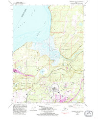
1979 Map of Anchorage B-8 SE
USGS Topo · Published 1993About this map
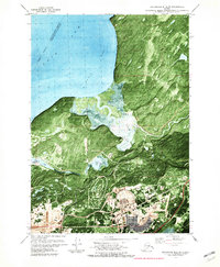
Military infrastructure and glacial terrain dominate the coastal landscape northeast of Anchorage, where the Fort Richardson Military Reservation and Elmendorf Air Force Base converge. The survey illustrates a specialized aviation and logistics hub, featuring the Seaplane Base on Sixmile Lake and the runways at Bryant Field. The transition from the tidal Knik Arm and Eagle Bay to the inland marshy Eagle River Flats reveals the complex geography of the region, punctuated by numerous kettle lakes like Otter Lake and Lake Beebe. Community and service features are concentrated along the southern corridor, including the Ursa Major School, John F. Kennedy Sch, and the National Cemetery. The presence of several Gravel Pits and firing ranges suggests the active development and operational use of these grounds during the late 20th century.
Find a feature on this map
40 named features on this map. Tap any name to fly to it.
Don’t see what you’re looking for? This feature index may not catch every label — zoom into the map to look around manually.
Map Details
Editions of this 1979 Anchorage B-8 SE Map
2 editions found
Other maps of this area

1951 · Anchorage
USGS Topo · 1:250,000

1952 · Anchorage A-8
USGS Topo · 1:63,360

1952 · Anchorage B-8
USGS Topo · 1:63,360

1953 · Anchorage A-8
USGS Topo · 1:63,360

1953 · Anchorage B-8
USGS Topo · 1:63,360

1960 · Anchorage B-7
USGS Topo · 1:63,360

1960 · Anchorage A-7
USGS Topo · 1:63,360

1962 · Anchorage
USGS Topo · 1:250,000

1965 · Anchorage B-8
USGS Topo · 1:63,360

1979 · Anchorage B-7 SW
USGS Topo · 1:25,000