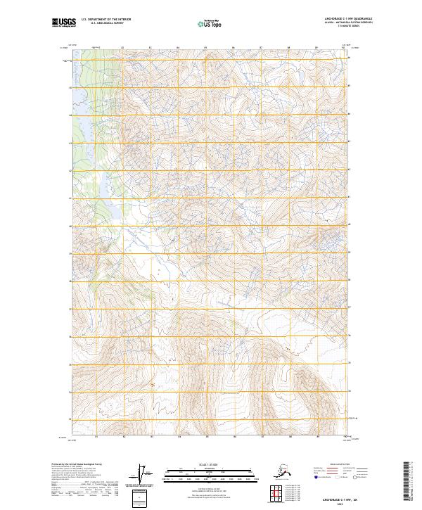
2023 Map of Anchorage C-1 NW
USGS Topo · Published 2023About this map
South Fork Matanuska River dominates the central portion of this remote drainage area, serving as the primary hydrological feature in this portion of the Matanuska-Susitna Borough. The landscape is defined by the convergence of mountain tributaries, including Middle Creek which flows from the north and the East Fork Matanuska River visible along the eastern margin. This 2023 survey illustrates a wilderness environment devoid of named settlements or roads, partitioned only by the Public Land Survey System grids of t19n r12e and t18n r12e. The contour density indicates steep elevation changes typical of the high Alaskan interior, where glacial runoff feeds the braided river systems that have historically shaped the regional geography.
Find a feature on this map
7 named features on this map. Tap any name to fly to it.
Don’t see what you’re looking for? This feature index may not catch every label — zoom into the map to look around manually.
Map Details
Editions of this 2023 Anchorage C-1 NW Map
This is the sole edition of this map. No revisions or reprints were ever made.
Other maps of this area

1948 · Anchorage D-2
USGS Topo · 1:63,360

1948 · Anchorage D-1
USGS Topo · 1:63,360

1951 · Anchorage
USGS Topo · 1:250,000

1951 · Anchorage D-1
USGS Topo · 1:63,360

1952 · Anchorage D-2
USGS Topo · 1:63,360

1960 · Anchorage C-2
USGS Topo · 1:63,360

1960 · Anchorage C-1
USGS Topo · 1:63,360

1962 · Anchorage
USGS Topo · 1:250,000
1976 · Anchorage D-2
USGS Topo · 1:63,360

1979 · Anchorage
USGS Topo · 1:250,000