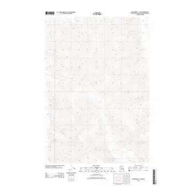
2013 Map of Anchorage C-2 NE
USGS Topo · Published 2013About this map
Matanuska Glacier defines the southwestern portion of this high-altitude landscape in the Talkeetna Mountains region. The topographic survey reveals the immense scale of the glacial ice and the steep, complex drainage patterns of the surrounding peaks during the early 21st century. High above the glacier, the headwaters of Rock Glacier Cr cut through the northern slopes, illustrating the relationship between active ice masses and the resulting alpine stream networks. This map provides a technical view of the undeveloped Alaskan wilderness within the Matanuska-Susitna Borough, focusing entirely on natural landforms and the township and range grid lines of Townships 18 and 19 North.
Find a feature on this map
4 named features on this map. Tap any name to fly to it.
Don’t see what you’re looking for? This feature index may not catch every label — zoom into the map to look around manually.
Map Details
Editions of this 2013 Anchorage C-2 NE Map
This is the sole edition of this map. No revisions or reprints were ever made.
Other maps of this area

1948 · Anchorage D-2
USGS Topo · 1:63,360

1948 · Anchorage D-1
USGS Topo · 1:63,360

1951 · Anchorage
USGS Topo · 1:250,000

1951 · Anchorage D-1
USGS Topo · 1:63,360

1952 · Anchorage D-2
USGS Topo · 1:63,360

1960 · Anchorage C-2
USGS Topo · 1:63,360

1960 · Anchorage C-1
USGS Topo · 1:63,360

1962 · Anchorage
USGS Topo · 1:250,000
1976 · Anchorage D-2
USGS Topo · 1:63,360

1979 · Anchorage
USGS Topo · 1:250,000