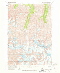
1960 Map of Anchorage C-3
USGS Topo · Published 1971About this map
Mount Sergeant Robinson anchors this high-elevation Alaskan wilderness in the Chugach Mountains, standing as a prominent landmark amidst a landscape defined by active ice and glacial runoff. The topography, mapped via aerial photography in 1957 and field-annotated in 1960, reveals a complex network of glacial flows and high-altitude drainage systems. Water from Glacier Creek and Monument Creek carves through the terrain, illustrating the constant movement of ice and water in the Matanuska-Susitna region. A distinctive technical detail on this sheet is the notation of Crevasses, providing a rare topographic record of the specific hazards and glacial conditions present during the late 1950s. These markings offer researchers a baseline for studying the shifting nature of the Alaska range before modern satellite monitoring, captured at a time when much of the land remained unsurveyed and unmarked by formal land lines.
Find a feature on this map
4 named features on this map. Tap any name to fly to it.
Don’t see what you’re looking for? This feature index may not catch every label — zoom into the map to look around manually.
Map Details
Editions of this 1960 Anchorage C-3 Map
2 editions found
Other maps of this area

1948 · Anchorage D-3
USGS Topo · 1:63,360

1948 · Anchorage D-2
USGS Topo · 1:63,360

1948 · Anchorage D-4
USGS Topo · 1:63,360

1951 · Anchorage
USGS Topo · 1:250,000

1952 · Anchorage D-2
USGS Topo · 1:63,360

1952 · Anchorage D-4
USGS Topo · 1:63,360

1952 · Anchorage D-3
USGS Topo · 1:63,360

1960 · Anchorage C-2
USGS Topo · 1:63,360

1960 · Anchorage B-4
USGS Topo · 1:63,360

1960 · Anchorage C-3
USGS Topo · 1:63,360