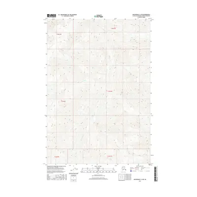
2016 Map of Anchorage C-4 SW
USGS Topo · Published 2016About this map
Metal Creek carves a significant drainage path through the high-elevation terrain of this Matanuska-Susitna region, joined by the headwaters of Cottonwood Creek and Friday Creek. This 2016 survey documents a landscape defined by dramatic vertical relief and glacial hydrology, where the absence of roads or permanent settlements underscores the primitive state of this mountain environment. The topographic data captures the intricate network of ridgelines and ravines within the Public Land Survey System boundaries of t17n r6e, t18n r6e, and surrounding townships. For the modern explorer or geologist, the map serves as a primary record of the seasonal drainage patterns and steep-walled valleys that characterize this portion of the Anchorage C-4 SW quadrangle.
Find a feature on this map
9 named features on this map. Tap any name to fly to it.
Don’t see what you’re looking for? This feature index may not catch every label — zoom into the map to look around manually.
Map Details
Editions of this 2016 Anchorage C-4 SW Map
This is the sole edition of this map. No revisions or reprints were ever made.
Other maps of this area

1951 · Anchorage
USGS Topo · 1:250,000

1951 · Anchorage C-5
USGS Topo · 1:63,360

1952 · Anchorage C-5
USGS Topo · 1:63,360

1960 · Anchorage C-5
USGS Topo · 1:63,360

1960 · Anchorage B-5
USGS Topo · 1:63,360

1960 · Anchorage B-4
USGS Topo · 1:63,360

1960 · Anchorage C-4
USGS Topo · 1:63,360

1962 · Anchorage
USGS Topo · 1:250,000

1979 · Anchorage
USGS Topo · 1:250,000

1994 · Anchorage B-4
USGS Topo · 1:63,360