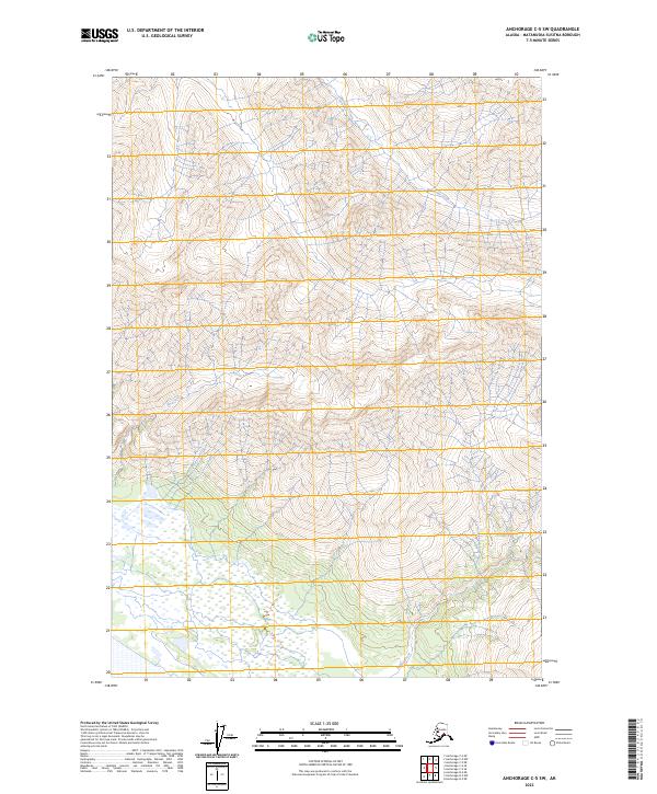
2023 Map of Anchorage C-5 SW
USGS Topo · Published 2023About this map
Wolverine Creek and Jim Creek define the complex hydrological landscape of the Matanuska-Susitna Borough as it appeared in the early 21st century. This survey area is characterized by steep elevation shifts and a dense network of mountain drainages, with Friday Creek cutting through the southern reaches. The map reflects the precision of modern topography, focusing on the high-altitude terrain and glacial watercourses rather than human settlements. The presence of detailed township and range boundaries, including t18n r3e and t17n r4e, provides a clear framework for understanding land division in this largely uninhabited portion of the Alaska interior.
Find a feature on this map
9 named features on this map. Tap any name to fly to it.
Don’t see what you’re looking for? This feature index may not catch every label — zoom into the map to look around manually.
Map Details
Editions of this 2023 Anchorage C-5 SW Map
This is the sole edition of this map. No revisions or reprints were ever made.
Other maps of this area

1951 · Anchorage
USGS Topo · 1:250,000

1951 · Anchorage C-6
USGS Topo · 1:63,360

1951 · Anchorage C-5
USGS Topo · 1:63,360

1952 · Anchorage C-5
USGS Topo · 1:63,360

1960 · Anchorage B-6
USGS Topo · 1:63,360

1960 · Anchorage C-5
USGS Topo · 1:63,360

1960 · Anchorage B-5
USGS Topo · 1:63,360

1962 · Anchorage
USGS Topo · 1:250,000
1979 · Anchorage C-6 SE
USGS Topo · 1:25,000
1979 · Anchorage C-6 NE
USGS Topo · 1:25,000