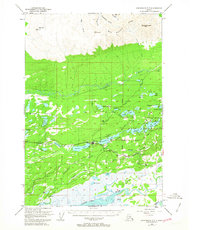
1950 Map of Anchorage C-7
USGS Topo · Published 1963About this map
Wasilla serves as the central hub of this 1950s Alaskan interior survey, positioned at the junction of The Alaska Railroad and the Palmer Wasilla Road. The landscape is a complex network of glacial lakes and marshy lowlands, including Lucile Lake, Wasilla Lake, and the larger Finger Lake. This era shows a developing infrastructure with the local Airport and a Gaging Sta near the town center, supporting the region's transition into a more settled transportation corridor.
Find a feature on this map
51 named features on this map. Tap any name to fly to it.
Don’t see what you’re looking for? This feature index may not catch every label — zoom into the map to look around manually.
Map Details
Editions of this 1950 Anchorage C-7 Map
2 editions found
Other maps of this area

1949 · Anchorage D-7
USGS Topo · 1:63,360

1949 · Anchorage D-8
USGS Topo · 1:63,360

1950 · Anchorage C-8
USGS Topo · 1:63,360

1950 · Anchorage D-6
USGS Topo · 1:63,360

1950 · Anchorage C-7
USGS Topo · 1:63,360

1951 · Anchorage
USGS Topo · 1:250,000

1951 · Anchorage C-6
USGS Topo · 1:63,360

1951 · Anchorage C-7
USGS Topo · 1:63,360

1951 · Anchorage D-8
USGS Topo · 1:63,360

1951 · Anchorage D-7
USGS Topo · 1:63,360