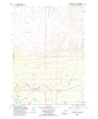
1979 Map of Anchorage C-7 NW
USGS Topo · Published 1993About this map
The Little Susitna River winds through the southern lowlands of this Matanuska-Susitna borough landscape, where a concentration of water bodies including Totuck Lake, June Lake, and Jaland Lake indicates a glaciated terrain. To the north, the topography rises sharply toward Moose Cone, defined by the drainage of West Fork Sawmill Creek and East Fork Sawmill Creek. This 1993 revision, based on photographs from the 1970s and 1980s, captures the early development of local infrastructure. A growing network of roads such as Pittman Road, Schrock Road, and Sitze Road provide access to various Gravel Pits, while a Winter Trail marks a more seasonal route through the northern tracts. The map also identifies aviation points including a Landing Strip and Landing Strip Road, alongside specialized features like the Radio Tower and Chignaki Pond.
Find a feature on this map
35 named features on this map. Tap any name to fly to it.
Don’t see what you’re looking for? This feature index may not catch every label — zoom into the map to look around manually.
Map Details
Editions of this 1979 Anchorage C-7 NW Map
2 editions found
Other maps of this area

1949 · Anchorage D-7
USGS Topo · 1:63,360

1949 · Anchorage D-8
USGS Topo · 1:63,360

1950 · Anchorage C-8
USGS Topo · 1:63,360

1950 · Anchorage C-7
USGS Topo · 1:63,360

1951 · Anchorage
USGS Topo · 1:250,000

1951 · Anchorage C-7
USGS Topo · 1:63,360

1951 · Anchorage D-8
USGS Topo · 1:63,360

1951 · Anchorage D-7
USGS Topo · 1:63,360

1952 · Anchorage C-7
USGS Topo · 1:63,360

1952 · Anchorage D-7
USGS Topo · 1:63,360