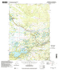
1994 Map of Anchorage C-8
USGS Topo · Published 2002About this map
The Alaska Railroad and George Parks Highway serve as the primary transit corridors through this portion of the Matanuska-Susitna Borough, connecting the community of Houston to the surrounding lake systems. This 1994 data reveals a landscape defined by an intricate network of water bodies, including Big Lake, Nancy Lake, and Horseshoe Lake, many of which are preserved within managed areas like the Nancy Lake State Recreation Area and the Big Lake South State Rec Site.
Find a feature on this map
88 named features on this map. Tap any name to fly to it.
Don’t see what you’re looking for? This feature index may not catch every label — zoom into the map to look around manually.
Map Details
Editions of this 1994 Anchorage C-8 Map
This is the sole edition of this map. No revisions or reprints were ever made.
Other maps of this area

1949 · Tyonek
USGS Topo · 1:250,000

1949 · Anchorage D-7
USGS Topo · 1:63,360

1949 · Anchorage D-8
USGS Topo · 1:63,360

1950 · Anchorage C-8
USGS Topo · 1:63,360

1950 · Anchorage C-7
USGS Topo · 1:63,360

1951 · Anchorage
USGS Topo · 1:250,000

1951 · Tyonek
USGS Topo · 1:250,000

1951 · Anchorage C-7
USGS Topo · 1:63,360

1951 · Anchorage D-8
USGS Topo · 1:63,360

1951 · Anchorage D-7
USGS Topo · 1:63,360