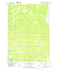
1979 Map of Anchorage C-8 NE
USGS Topo · Published 1979About this map
The Little Susitna River meanders across the southern landscape of this 1979 survey, defining a corridor of transport and utility near the edge of the Houston Corporate Boundary. Evidence of local infrastructure is clear along the riverbanks, where a Landing Strip, a Gravel Pit, and a Campground suggest a hub of seasonal activity and resource extraction. The northern and central sections are characterized by a network of water bodies and seasonal paths, including the prominent Winter Trail and the winding course of Deception Creek. Scattered lakes such as Teakwood Lake, Zero Lake, and Bench Lake punctuate the terrain, illustrating the natural drainage patterns of the Matanuska-Susitna region during this era of late-twentieth-century development.
Find a feature on this map
12 named features on this map. Tap any name to fly to it.
Don’t see what you’re looking for? This feature index may not catch every label — zoom into the map to look around manually.
Map Details
Editions of this 1979 Anchorage C-8 NE Map
2 editions found
Other maps of this area

1949 · Anchorage D-7
USGS Topo · 1:63,360

1949 · Anchorage D-8
USGS Topo · 1:63,360

1950 · Anchorage C-8
USGS Topo · 1:63,360

1950 · Anchorage C-7
USGS Topo · 1:63,360

1951 · Anchorage
USGS Topo · 1:250,000

1951 · Anchorage C-7
USGS Topo · 1:63,360

1951 · Anchorage D-8
USGS Topo · 1:63,360

1951 · Anchorage D-7
USGS Topo · 1:63,360

1952 · Anchorage C-7
USGS Topo · 1:63,360

1952 · Anchorage D-7
USGS Topo · 1:63,360