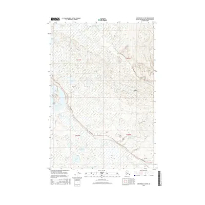
2016 Map of Anchorage C-8 NW
USGS Topo · Published 2016About this map
Willow and Houston Lake anchor this 2016 survey of the Matanuska-Susitna Borough, where the transportation network of the Parks Highway and the Old Parks Highway dictates the modern settlement pattern. The landscape is defined by its extensive aviation infrastructure, featuring several private and community landing fields including Pan Lake Strip, Satterbergs Airport, and Black Spruce Airport. The watery terrain is a complex of named lakes and streams, from the large Nancy Lake and its Waldron Island to the winding course of the Little Susitna River and Deception Creek. This map illustrates how development has followed the high ground between these marshes and water bodies, with residential clusters linked by roads such as Zero Lake Road and Lynx Lake Road.
Find a feature on this map
33 named features on this map. Tap any name to fly to it.
Don’t see what you’re looking for? This feature index may not catch every label — zoom into the map to look around manually.
Map Details
Editions of this 2016 Anchorage C-8 NW Map
This is the sole edition of this map. No revisions or reprints were ever made.
Other maps of this area

1949 · Tyonek
USGS Topo · 1:250,000

1949 · Anchorage D-8
USGS Topo · 1:63,360

1950 · Anchorage C-8
USGS Topo · 1:63,360

1951 · Anchorage
USGS Topo · 1:250,000

1951 · Tyonek
USGS Topo · 1:250,000

1951 · Anchorage D-8
USGS Topo · 1:63,360

1952 · Anchorage C-8
USGS Topo · 1:63,360

1952 · Tyonek D-1
USGS Topo · 1:63,360

1952 · Tyonek C-1
USGS Topo · 1:63,360

1952 · Anchorage D-8
USGS Topo · 1:63,360