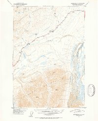
1951 Map of Anchorage D-1
USGS Topo · Published 1952About this map
Eureka Roadhouse serves as a lonely outpost along the Glenn Highway in this mid-century portrait of the high country between the Talkeetna Mountains and the Chugach Mountains. The landscape is defined by the critical transit corridor through Tahneta Pass, where the road and a secondary Tractor Trail navigate the divide between the Nelchina River and the headwaters of the Matanuska River. Aerial photography from 1948 reveals a sparse infrastructure composed of an isolated Airstrip, a small Cabin, and a network of high-altitude water bodies including Eureka Lake and Lake Leila. The map captures a moment when this section of the interior was just beginning to be formalized for vehicular travel, showing numerous survey markers and peaks like Table Mtn and VABM 6184 China that guided early navigation through the passes.
Find a feature on this map
31 named features on this map. Tap any name to fly to it.
Don’t see what you’re looking for? This feature index may not catch every label — zoom into the map to look around manually.
Map Details
Editions of this 1951 Anchorage D-1 Map
3 editions found
Other maps of this area

1948 · Anchorage D-2
USGS Topo · 1:63,360

1948 · Anchorage D-1
USGS Topo · 1:63,360

1949 · Talkeetna Mountains A-1
USGS Topo · 1:63,360

1949 · Gulkana A-6
USGS Topo · 1:63,360

1949 · Valdez D-8
USGS Topo · 1:63,360

1950 · Talkeetna Mountains
USGS Topo · 1:250,000

1951 · Gulkana
USGS Topo · 1:250,000

1951 · Anchorage
USGS Topo · 1:250,000

1951 · Anchorage D-1
USGS Topo · 1:63,360

1952 · Valdez D-8
USGS Topo · 1:63,360