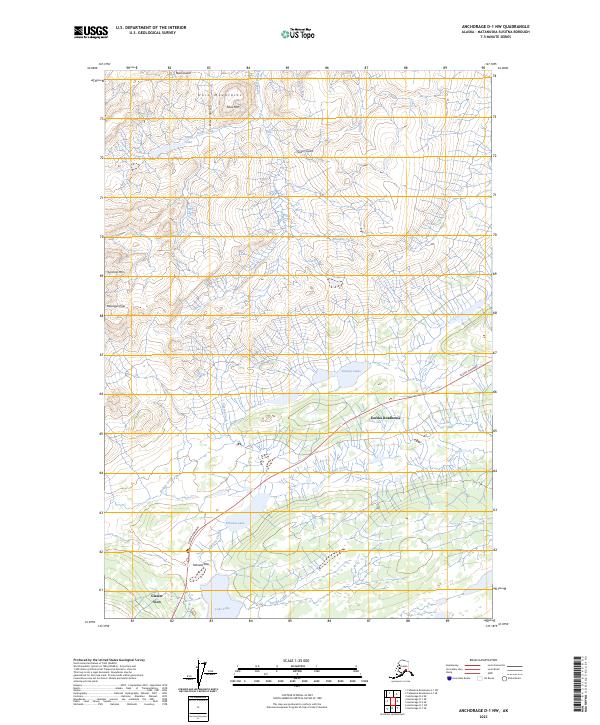
2023 Map of Anchorage D-1 NW
USGS Topo · Published 2023About this map
Eureka Roadhouse serves as a central landmark along the Glenn Highway in this portion of the Matanuska-Susitna Borough. The landscape is characterized by the high peaks of the Horn Mountains, featuring Table Mtn and Syncline Mtn, which transition into a complex drainage system fed by Crooked Creek, Poorman Creek, and Eureka Creek. The alignment of the highway follows the natural break at Tahneta Pass, a critical corridor for interior travel. Local hydrology is defined by numerous high-altitude water bodies including Tahneta Lake, Lake Leila, and the cluster of Startup Lakes. To the southwest, the community of Glacier View marks the proximity to the massive ice fields just beyond the map's margin, illustrating the intersection of transportation routes and the dramatic Alaskan wilderness.
Find a feature on this map
29 named features on this map. Tap any name to fly to it.
Don’t see what you’re looking for? This feature index may not catch every label — zoom into the map to look around manually.
Map Details
Editions of this 2023 Anchorage D-1 NW Map
This is the sole edition of this map. No revisions or reprints were ever made.
Other maps of this area

1948 · Anchorage D-2
USGS Topo · 1:63,360

1948 · Anchorage D-1
USGS Topo · 1:63,360

1949 · Talkeetna Mountains A-1
USGS Topo · 1:63,360

1950 · Talkeetna Mountains
USGS Topo · 1:250,000

1951 · Anchorage
USGS Topo · 1:250,000

1951 · Anchorage D-1
USGS Topo · 1:63,360

1952 · Anchorage D-2
USGS Topo · 1:63,360
1952 · Talkeetna Mountains A-1
USGS Topo · 1:63,360

1954 · Talkeetna Mountains
USGS Topo · 1:250,000
1957 · Talkeetna Mountains
USGS Topo · 1:250,000