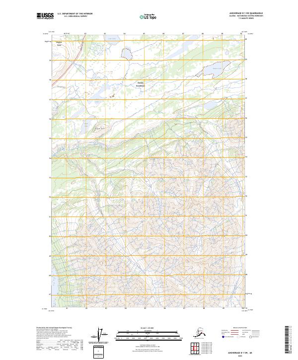
2023 Map of Anchorage D-1 SW
USGS Topo · Published 2023About this map
Eureka Roadhouse and the small settlement of Glacier View anchor the northern reaches of this Alaskan landscape, positioned along the vital corridor of the Glenn Highway. The map details a transition from the accessible roadside areas, including Alascom Road, into the drainage systems of the East Fork Matanuska River. This high-elevation terrain is defined by its hydrography, where alpine water bodies like Lake Leila, Trail Lake, and Knob Lake feed into local tributaries including Trail Creek and Middle Creek. The prominence of Knob Hill provides a distinct topographical landmark in an area otherwise dominated by the expansive valley of the river's east fork. The layout of these features reflects the remote nature of the Matanuska-Susitna region, where human activity is tightly clustered near the primary highway artery.
Find a feature on this map
17 named features on this map. Tap any name to fly to it.
Don’t see what you’re looking for? This feature index may not catch every label — zoom into the map to look around manually.
Map Details
Editions of this 2023 Anchorage D-1 SW Map
This is the sole edition of this map. No revisions or reprints were ever made.
Other maps of this area

1948 · Anchorage D-2
USGS Topo · 1:63,360

1948 · Anchorage D-1
USGS Topo · 1:63,360

1951 · Anchorage
USGS Topo · 1:250,000

1951 · Anchorage D-1
USGS Topo · 1:63,360

1952 · Anchorage D-2
USGS Topo · 1:63,360

1960 · Anchorage C-2
USGS Topo · 1:63,360

1960 · Anchorage C-1
USGS Topo · 1:63,360

1962 · Anchorage
USGS Topo · 1:250,000
1976 · Anchorage D-2
USGS Topo · 1:63,360

1979 · Anchorage
USGS Topo · 1:250,000