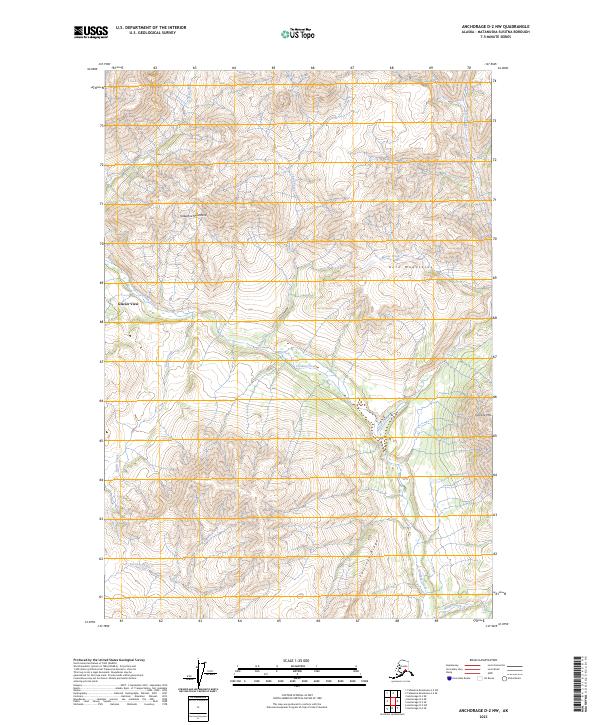
2023 Map of Anchorage D-2 NW
USGS Topo · Published 2023About this map
Talkeetna Mountains and the Horn Mountains define this high-altitude landscape in the Matanuska-Susitna region. The terrain is characterized by dramatic elevation changes, notably along the prominent Fortress Ridge and near the landmark of Glacier View. A dense network of drainage systems feeds through these peaks, including Caribou Creek and Sheep Creek, which carve deep valleys through the mountain ranges.
Find a feature on this map
18 named features on this map. Tap any name to fly to it.
Don’t see what you’re looking for? This feature index may not catch every label — zoom into the map to look around manually.
Map Details
Editions of this 2023 Anchorage D-2 NW Map
This is the sole edition of this map. No revisions or reprints were ever made.
Other maps of this area

1948 · Anchorage D-3
USGS Topo · 1:63,360

1948 · Anchorage D-2
USGS Topo · 1:63,360

1950 · Talkeetna Mountains
USGS Topo · 1:250,000

1951 · Anchorage
USGS Topo · 1:250,000

1951 · Talkeetna Mountains A-2
USGS Topo · 1:63,360

1952 · Anchorage D-2
USGS Topo · 1:63,360

1952 · Anchorage D-3
USGS Topo · 1:63,360
1952 · Talkeetna Mountains A-2
USGS Topo · 1:63,360

1954 · Talkeetna Mountains
USGS Topo · 1:250,000
1957 · Talkeetna Mountains
USGS Topo · 1:250,000