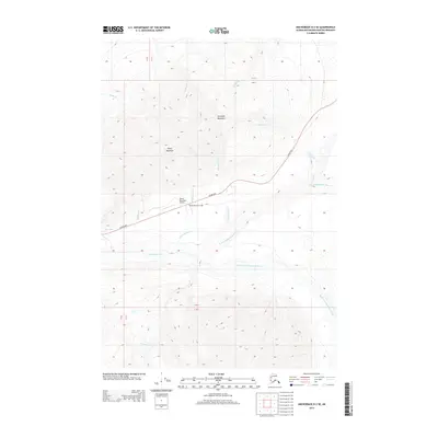
2013 Map of Anchorage D-2 SE
USGS Topo · Published 2013About this map
Sheep Mountain Lodge and the adjacent Sheep Mountain Airport serve as a focal point of human activity along the Glenn Hwy in this high-altitude corridor. The landscape is defined by the massive presence of Sheep Mountain and Gunsight Mountain, which stand watch over the confluence of glacial drainages. This 2013 survey illustrates the complex hydrology of the region, where the E Fork Matanuska River and South Fork Matanuska River merge to form the Matanuska River. Numerous smaller tributaries like Inoceramus Cr, Yellow Jacket Cr, and Rock Glacier Cr cut through the steep topography, while Bug Lake sits near the western edge of the highway. The map provides a detailed view of the infrastructure and natural features that support transportation and recreation in this part of the Matanuska-Susitna Borough.
Find a feature on this map
21 named features on this map. Tap any name to fly to it.
Don’t see what you’re looking for? This feature index may not catch every label — zoom into the map to look around manually.
Map Details
Editions of this 2013 Anchorage D-2 SE Map
This is the sole edition of this map. No revisions or reprints were ever made.
Other maps of this area

1948 · Anchorage D-2
USGS Topo · 1:63,360

1948 · Anchorage D-1
USGS Topo · 1:63,360

1951 · Anchorage
USGS Topo · 1:250,000

1951 · Anchorage D-1
USGS Topo · 1:63,360

1952 · Anchorage D-2
USGS Topo · 1:63,360

1960 · Anchorage C-2
USGS Topo · 1:63,360

1960 · Anchorage C-1
USGS Topo · 1:63,360

1962 · Anchorage
USGS Topo · 1:250,000
1976 · Anchorage D-2
USGS Topo · 1:63,360

1979 · Anchorage
USGS Topo · 1:250,000