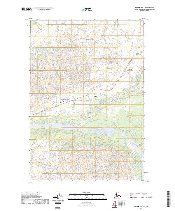
2023 Map of Anchorage D-2 SE
USGS Topo · Published 2023About this map
Glenn Highway cuts through this high-altitude landscape where the Matanuska River system begins to branch into its major mountain-fed forks. The geography is defined by the massive presence of Sheep Mtn and Gunsight Mtn, which tower over the surrounding drainage basins of Gunsight Creek and Bitter Creek. This area represents a critical corridor for travel and aviation in the Matanuska-Susitna region, anchored by the long-standing waypoint at Eureka Roadhouse and the remote Sheep Mountain Airport.
Find a feature on this map
27 named features on this map. Tap any name to fly to it.
Don’t see what you’re looking for? This feature index may not catch every label — zoom into the map to look around manually.
Map Details
Editions of this 2023 Anchorage D-2 SE Map
This is the sole edition of this map. No revisions or reprints were ever made.
Other maps of this area

1948 · Anchorage D-2
USGS Topo · 1:63,360

1948 · Anchorage D-1
USGS Topo · 1:63,360

1951 · Anchorage
USGS Topo · 1:250,000

1951 · Anchorage D-1
USGS Topo · 1:63,360

1952 · Anchorage D-2
USGS Topo · 1:63,360

1960 · Anchorage C-2
USGS Topo · 1:63,360

1960 · Anchorage C-1
USGS Topo · 1:63,360

1962 · Anchorage
USGS Topo · 1:250,000
1976 · Anchorage D-2
USGS Topo · 1:63,360

1979 · Anchorage
USGS Topo · 1:250,000