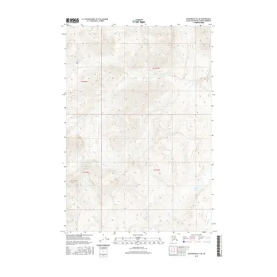
2016 Map of Anchorage D-3 NE
USGS Topo · Published 2016About this map
Mt Monarch stands as a prominent high point in this high-elevation landscape of the Matanuska-Susitna region, where the terrain is defined by deeply carved drainage systems and alpine passes. The map document's complex contour lines reveal the steep transitions between the headwaters of Chitna Cr and the neighboring Caribou Cr. This 2016 survey illustrates a largely roadless wilderness, prioritizing the precise tracking of natural hydrography and glacial-cut features rather than human settlement.
Find a feature on this map
12 named features on this map. Tap any name to fly to it.
Don’t see what you’re looking for? This feature index may not catch every label — zoom into the map to look around manually.
Map Details
Editions of this 2016 Anchorage D-3 NE Map
This is the sole edition of this map. No revisions or reprints were ever made.
Other maps of this area

1948 · Anchorage D-3
USGS Topo · 1:63,360

1948 · Anchorage D-2
USGS Topo · 1:63,360

1950 · Talkeetna Mountains
USGS Topo · 1:250,000

1951 · Anchorage
USGS Topo · 1:250,000

1951 · Talkeetna Mountains A-2
USGS Topo · 1:63,360

1952 · Anchorage D-2
USGS Topo · 1:63,360

1952 · Anchorage D-3
USGS Topo · 1:63,360
1952 · Talkeetna Mountains A-2
USGS Topo · 1:63,360

1954 · Talkeetna Mountains
USGS Topo · 1:250,000
1957 · Talkeetna Mountains
USGS Topo · 1:250,000