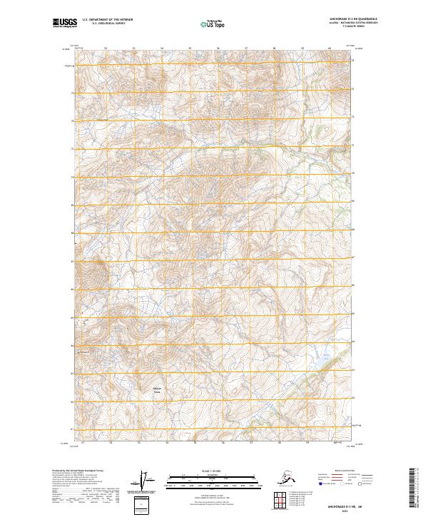
2023 Map of Anchorage D-3 NE
USGS Topo · Published 2023About this map
Mt Monarch rises as a dominant landmark in this high-altitude landscape of the Matanuska-Susitna Borough. The terrain is defined by its dramatic glacial drainage patterns, where Chitna Creek and Caribou Creek carve through the deep relief of the Talkeetna Mountains. This 2023 survey illustrates the complex topography surrounding Chitna Pass, a natural corridor through the high peaks. The southeastern portion of the map is punctuated by Hicks Lake and the headwaters of Hicks Creek, which feed into the larger regional watershed. The labeling of Glacier View reflects the area's orientation toward the expansive ice fields just beyond the peaks, marking a landscape where high-mountain hydrology dictates the sparse human footprint.
Find a feature on this map
13 named features on this map. Tap any name to fly to it.
Don’t see what you’re looking for? This feature index may not catch every label — zoom into the map to look around manually.
Map Details
Editions of this 2023 Anchorage D-3 NE Map
This is the sole edition of this map. No revisions or reprints were ever made.
Other maps of this area

1948 · Anchorage D-3
USGS Topo · 1:63,360

1948 · Anchorage D-2
USGS Topo · 1:63,360

1950 · Talkeetna Mountains
USGS Topo · 1:250,000

1951 · Anchorage
USGS Topo · 1:250,000

1951 · Talkeetna Mountains A-2
USGS Topo · 1:63,360

1952 · Anchorage D-2
USGS Topo · 1:63,360

1952 · Anchorage D-3
USGS Topo · 1:63,360
1952 · Talkeetna Mountains A-2
USGS Topo · 1:63,360

1954 · Talkeetna Mountains
USGS Topo · 1:250,000
1957 · Talkeetna Mountains
USGS Topo · 1:250,000