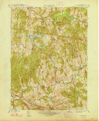
1948 Map of Ancram
USGS Topo · Published 1948About this map
Roeliff Jansen Kill winds through the southern landscape of this Columbia County region, anchoring a network of small hamlets and early industrial sites just after the Second World War. The map details a rural economy centered on water power and community institutions, prominently featuring the Spaulding Furnace near Snake Hill. Settlement patterns are defined by clusters of activity at Gallatinville, West Taghkanic, and Ancram, with the agricultural character of the era evidenced by scattered one-room schoolhouses like School No 10 and Suydam Sch. To the north, Lake Taghkanic and Pond Lily Pond dominate the upland terrain, while the southern boundary follows the Columbia and Dutchess County line. Local genealogy is well-served by landmarks such as Vedder Ch and named family locations like Silvernails, providing a clear view of the social geography of the late 1940s.
Find a feature on this map
31 named features on this map. Tap any name to fly to it.
Don’t see what you’re looking for? This feature index may not catch every label — zoom into the map to look around manually.
Map Details
Editions of this 1948 Ancram Map
2 editions found
Other maps of this area

1895 · Catskill
USGS Topo · 1:62,500

1898 · Rhinebeck
USGS Topo · 1:62,500

1899 · Millbrook
USGS Topo · 1:62,500

1902 · Millbrook
USGS Topo · 1:62,500

1902 · Copake
USGS Topo · 1:62,500

1904 · Copake
USGS Topo · 1:62,500

1934 · Rhinebeck
USGS Topo · 1:48,000

1934 · Catskill
USGS Topo · 1:62,500

1938 · Catskill
USGS Topo · 1:62,500

1939 · Rhinebeck
USGS Topo · 1:62,500