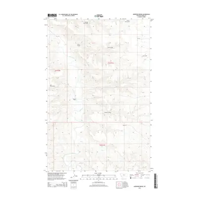
2014 Map of Anderson Bridge
USGS Topo · Published 2014About this map
The Judith River meanders through this portion of Fergus County, cutting a deep path through a landscape defined by dramatic elevation changes and numerous drainage coulees. The settlement at Anderson Bridge serves as a focal point in an area where the terrain rises sharply toward the Bear Springs Bench in the west. This 2014 survey illustrates the complex topography of the Montana plains, where water has carved out features such as Seventy Nine Coulee, Brown Coulee, and Anderson Coulee. The rural infrastructure is represented by a network of local routes, including the descriptive 3 Mile Rd and Paradise Rd, which provide access across the broken ground and seasonal waterways like Salt Cr.
Find a feature on this map
15 named features on this map. Tap any name to fly to it.
Don’t see what you’re looking for? This feature index may not catch every label — zoom into the map to look around manually.
Map Details
Editions of this 2014 Anderson Bridge Map
This is the sole edition of this map. No revisions or reprints were ever made.
Other maps of this area

1954 · P N Ranch
USGS Topo · 1:24,000

1954 · Gallatin Rapids
USGS Topo · 1:24,000

1954 · Council Island
USGS Topo · 1:24,000

1954 · Lewistown
USGS Topo · 1:250,000

1959 · Lewistown
USGS Topo · 1:250,000

1964 · Wolf Creek Falls
USGS Topo · 1:24,000

1964 · Anderson Bridge
USGS Topo · 1:24,000

1978 · Wild Bill Flat West
USGS Topo · 1:24,000

1978 · Wild Bill Flat East
USGS Topo · 1:24,000

1978 · Lewistown
USGS Topo · 1:100,000