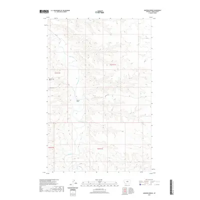
2020 Map of Anderson Bridge
USGS Topo · Published 2020About this map
The Judith River carves a deep, winding course through this section of Fergus County, defining the agricultural and ranching landscape of central Montana. At the center of the sheet, the river crossing at Anderson Bridge serves as a primary waypoint, connecting isolated ranch lands to the broader region via Judith River Rd. To the west, the flat expanse of Bear Springs Bench rises above the river valley, providing a distinct geographic contrast to the intricate coulees and drainages that feed into Salt Cr in the south. The road network, including the utilitarian 3 Mile Rd and the W 79 Trl, reveals the enduring spatial organization of this rural territory, where land use is dictated by the rugged breaks of the river corridor and the high benches between them.
Find a feature on this map
12 named features on this map. Tap any name to fly to it.
Don’t see what you’re looking for? This feature index may not catch every label — zoom into the map to look around manually.
Map Details
Editions of this 2020 Anderson Bridge Map
This is the sole edition of this map. No revisions or reprints were ever made.
Other maps of this area

1954 · P N Ranch
USGS Topo · 1:24,000

1954 · Gallatin Rapids
USGS Topo · 1:24,000

1954 · Council Island
USGS Topo · 1:24,000

1954 · Lewistown
USGS Topo · 1:250,000

1959 · Lewistown
USGS Topo · 1:250,000

1964 · Wolf Creek Falls
USGS Topo · 1:24,000

1964 · Anderson Bridge
USGS Topo · 1:24,000

1978 · Wild Bill Flat West
USGS Topo · 1:24,000

1978 · Wild Bill Flat East
USGS Topo · 1:24,000

1978 · Lewistown
USGS Topo · 1:100,000