Loading...
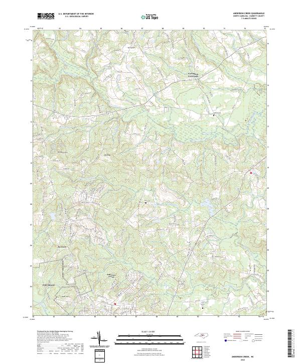
Loading map...2022 Map of Anderson Creek
USGS Topo · Published 2022About this map
The Upper Little River and its numerous tributaries, including Little Rocky Run and Horse-Pen Br, carve a complex drainage pattern across this Harnett County landscape. Rural crossroads and small communities such as Spring Hill and Norrington Crossroads anchor the northern reaches, while the area around Hairtown and Anderson Creek shows the transition from traditional woodlots to residential developments like Alabama Hills.
Find a feature on this map
161 named features on this map. Tap any name to fly to it.
Don’t see what you’re looking for? This feature index may not catch every label — zoom into the map to look around manually.
Map Details
Date Portrayed2022
Date Published2022
PublisherU.S. Geological Survey
Map TypeTopographic
Scale1:24000
Physical Dimensions24 x 29 inches
Editions of this 2022 Anderson Creek Map
This is the sole edition of this map. No revisions or reprints were ever made.
Historical Maps of Anderson Creek Through Time
Featured Locations
Source Details
SourceU.S. Geological Survey
CopyrightPublic Domain