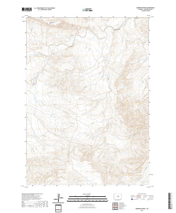
2021 Map of Anderson Draw
USGS Topo · Published 2021About this map
S Fork Powder River defines the drainage patterns of this high-plains landscape in Natrona County. The terrain is characterized by dramatic elevation changes, most notably along the Cottonwood Rim in the northwest and the deep incisions of Anderson Draw and Ellis Draw to the northeast. These landforms provide a clear view of the erosion-driven topography typical of the region, where seasonal watercourses like Cottonwood Cr and Indian Cr have shaped the earth over millennia.
Find a feature on this map
12 named features on this map. Tap any name to fly to it.
Don’t see what you’re looking for? This feature index may not catch every label — zoom into the map to look around manually.
Map Details
Editions of this 2021 Anderson Draw Map
This is the sole edition of this map. No revisions or reprints were ever made.
Other maps of this area

1955 · Arminto
USGS Topo · 1:250,000

1958 · Arminto
USGS Topo · 1:250,000

1962 · Arminto
USGS Topo · 1:250,000

1968 · Reynolds Reservoir
USGS Topo · 1:24,000

1968 · Big Sulfur Draw
USGS Topo · 1:24,000

1968 · Fiftymile Flat
USGS Topo · 1:24,000
1968 · Burlington Lake
USGS Topo · 1:24,000
1968 · Anderson Draw
USGS Topo · 1:24,000
1968 · Natrona
USGS Topo · 1:24,000

1968 · Flat Top Hill
USGS Topo · 1:24,000