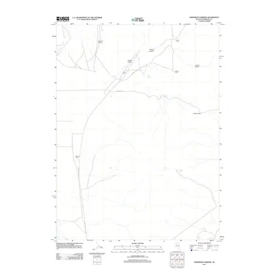
2011 Map of Anderson Gardens
USGS Topo · Published 2011About this map
Frazier Ranch and the eponymous Anderson Gardens define the human footprint in this northern Humboldt County landscape, where ranching interests align with the natural topography of the Great Basin. The network of canyons including Delvada Canyon, Goughs Canyon, and Porphyry Canyon underscores a drainage pattern that funnels toward more open basins, while the presence of Soldier Spring indicates the critical importance of water sources in this arid environment. Transportation through the area relies on the Eden Valley Rd and the significant crossing at Soldier Pass. The inclusion of landmarks like Stone Corral and Round Hill suggests a history of local navigation and land use by early settlers and ranchers who managed livestock across these canyon-riven stretches of the Nevada interior.
Find a feature on this map
12 named features on this map. Tap any name to fly to it.
Don’t see what you’re looking for? This feature index may not catch every label — zoom into the map to look around manually.
Map Details
Editions of this 2011 Anderson Gardens Map
This is the sole edition of this map. No revisions or reprints were ever made.
Other maps of this area

1882 · Paradise
USGS Topo · 1:250,000

1893 · Paradise
USGS Topo · 1:250,000

1932 · Sonoma Range
USGS Topo · 1:250,000

1939 · Sonoma Range
USGS Topo · 1:250,000

1945 · Osgood Mountains
USGS Topo · 1:62,500

1947 · Osgood Mountains
USGS Topo · 1:62,500

1955 · McDermitt
USGS Topo · 1:250,000

1955 · Winnemucca
USGS Topo · 1:250,000

1958 · Winnemucca
USGS Topo · 1:250,000

1958 · Winnemucca
USGS Topo · 1:62,500