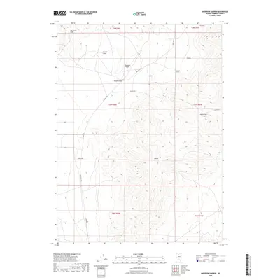
2018 Map of Anderson Gardens
USGS Topo · Published 2018About this map
The Osgood Mountains dominate the central and southeastern portion of this terrain, showing the high-elevation basin and range geography of Humboldt County. Settlement is sparse, anchored by Anderson Gardens on the eastern slopes, with the primary transit artery being the north-south Eden Valley Rd. The landscape is carved by numerous drainages, including Porphyry Canyon, Goughs Canyon, and Delvada Canyon, which flow out from the heights toward the valley floor. To the northwest, the edge of the Hot Springs Range is visible, while critical water sources like Soldier Spring represent vital points in this arid environment. The map details the intersection of high ridges and deep canyons, specifically at Soldier Pass, illustrating the traditional routes used to navigate these mountain barriers.
Find a feature on this map
18 named features on this map. Tap any name to fly to it.
Don’t see what you’re looking for? This feature index may not catch every label — zoom into the map to look around manually.
Map Details
Editions of this 2018 Anderson Gardens Map
This is the sole edition of this map. No revisions or reprints were ever made.
Other maps of this area

1882 · Paradise
USGS Topo · 1:250,000

1893 · Paradise
USGS Topo · 1:250,000

1932 · Sonoma Range
USGS Topo · 1:250,000

1939 · Sonoma Range
USGS Topo · 1:250,000

1945 · Osgood Mountains
USGS Topo · 1:62,500

1947 · Osgood Mountains
USGS Topo · 1:62,500

1955 · McDermitt
USGS Topo · 1:250,000

1955 · Winnemucca
USGS Topo · 1:250,000

1958 · Winnemucca
USGS Topo · 1:250,000

1958 · Winnemucca
USGS Topo · 1:62,500