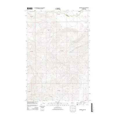
2013 Map of Anderson Lake
USGS Topo · Published 2013About this map
National Mountain Lookout stands as a central vantage point over this section of the Cascade foothills, where the Pierce Co Lewis Co boundary line divides the landscape. The northern edge of the map is defined by the Nisqually River as it passes near the community of Ashford, a gateway for travelers. This 2013 survey illustrates a complex network of drainage basins, with Lake Creek feeding into the namesake Anderson Lake. The terrain is deeply etched by numerous waterways including N Fork Mineral Cr, Mineral Cr, and Gallup Creek, showing the intricate hydrology of the region. Forestry and access routes are indicated by thoroughfares such as NFD Rd and Blue Bird Rd, which trace the contours of the high-elevation ridges and valleys between the river systems.
Find a feature on this map
59 named features on this map. Tap any name to fly to it.
Don’t see what you’re looking for? This feature index may not catch every label — zoom into the map to look around manually.
Map Details
Editions of this 2013 Anderson Lake Map
This is the sole edition of this map. No revisions or reprints were ever made.
Other maps of this area

1924 · Mt Rainier
USGS Topo · 1:96,000

1928 · Mt Rainier
USGS Topo · 1:125,000

1937 · Eatonville
USGS Topo · 1:125,000

1950 · Yakima
USGS Topo · 1:250,000

1953 · Hoquiam
USGS Topo · 1:250,000

1956 · Mineral
USGS Topo · 1:62,500

1956 · Kapowsin
USGS Topo · 1:62,500

1957 · Hoquiam
USGS Topo · 1:250,000

1958 · Yakima
USGS Topo · 1:250,000

1958 · Hoquiam
USGS Topo · 1:250,000