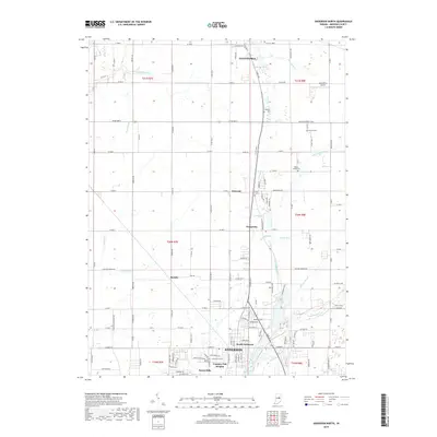
2019 Map of Anderson North
USGS Topo · Published 2019About this map
Alexandria anchors the northern edge of this Madison County survey, where the local landscape is defined by the agricultural grid and several distinct drainage systems. The map captures the suburban expansion north of Anderson, including neighborhoods such as North Anderson, Country Club Heights, and Forest Hills. Moving north through the rural sections, the terrain is marked by historical infrastructure and small settlements like Linwood, Prosperity, and Florida. The presence of an Old Canal remnant near Linwood indicates the area's early transportation history. Waterways like Killbuck Creek, Pipe Creek, and Little Killbuck Cr snake through the township sections, often bordered by small family cemeteries such as Smith Cem and Donahoo Cem. These small burial grounds, along with the Wesley Chapel Cem, provide essential anchor points for genealogists tracing the local farming families who established these townships.
Find a feature on this map
132 named features on this map. Tap any name to fly to it.
Don’t see what you’re looking for? This feature index may not catch every label — zoom into the map to look around manually.
Map Details
Editions of this 2019 Anderson North Map
This is the sole edition of this map. No revisions or reprints were ever made.
Other maps of this area

1952 · Anderson
USGS Topo · 1:24,000

1953 · Lapel
USGS Topo · 1:24,000

1953 · Muncie
USGS Topo · 1:250,000

1956 · Muncie
USGS Topo · 1:250,000

1960 · Gilman
USGS Topo · 1:24,000

1960 · Elwood
USGS Topo · 1:24,000

1960 · Middletown
USGS Topo · 1:24,000

1960 · Alexandria
USGS Topo · 1:24,000

1960 · Gaston
USGS Topo · 1:24,000

1960 · Anderson North
USGS Topo · 1:24,000