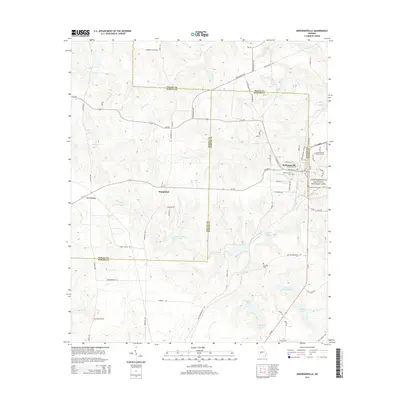
2014 Map of Andersonville
USGS Topo · Published 2014About this map
Andersonville National Historic Site and its associated Andersonville National Cem anchor the eastern edge of this modern survey at the junction of Macon and Sumter counties. The landscape is defined by its water systems, notably the Sweetwater Cr basin, which includes Sweetwater Mineral Springs and several privately named bodies of water such as John James Lake, Charles Reeves Lake, and Tharpe Lake.
Find a feature on this map
66 named features on this map. Tap any name to fly to it.
Don’t see what you’re looking for? This feature index may not catch every label — zoom into the map to look around manually.
Map Details
Editions of this 2014 Andersonville Map
This is the sole edition of this map. No revisions or reprints were ever made.
Other maps of this area

1955 · Phenix City
USGS Topo · 1:250,000

1957 · Phenix City
USGS Topo · 1:250,000

1958 · Phenix City
USGS Topo · 1:250,000

1971 · Ideal South
USGS Topo · 1:24,000

1971 · Ellaville North
USGS Topo · 1:24,000

1971 · Montezuma
USGS Topo · 1:24,000

1972 · Ellaville South
USGS Topo · 1:24,000
1972 · Methvins
USGS Topo · 1:24,000
1972 · Andersonville
USGS Topo · 1:24,000
1972 · Pennington
USGS Topo · 1:24,000