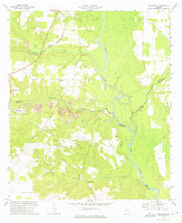
1972 Map of Pennington
USGS Topo · Published 1975About this map
The Flint River carves a winding path through this corner of Central Georgia, where the boundaries of Macon, Sumter, and Dooly counties meet. Extensive strip mines dominate the landscape west of the river, marked by complex excavation patterns and industrial waste ponds near the Central of Georgia railroad line. This industrial activity contrasts with the agricultural and commemorative character of the surrounding land, which includes the eastern edge of the Andersonville Nat Hist Site.
Find a feature on this map
41 named features on this map. Tap any name to fly to it.
Don’t see what you’re looking for? This feature index may not catch every label — zoom into the map to look around manually.
Map Details
Editions of this 1972 Pennington Map
This is the sole edition of this map. No revisions or reprints were ever made.
Other maps of this area

1955 · Phenix City
USGS Topo · 1:250,000

1957 · Phenix City
USGS Topo · 1:250,000

1957 · Macon
USGS Topo · 1:250,000

1958 · Macon
USGS Topo · 1:250,000

1958 · Phenix City
USGS Topo · 1:250,000

1964 · Macon
USGS Topo · 1:250,000

1971 · Ideal South
USGS Topo · 1:24,000

1971 · Montezuma
USGS Topo · 1:24,000

1972 · Byromville
USGS Topo · 1:24,000

1972 · Drayton
USGS Topo · 1:24,000