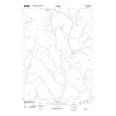
2010 Map of Andes
USGS Topo · Published 2010About this map
Andes serves as the central hub of this Catskills landscape, where the valley topography dictates the path of commerce and travel. The settlement is concentrated near the confluence of Tremper Kill and Liddle Brook, with the Rural Cemetery overlooking the town from a nearby slope. This 2010 survey illustrates a deeply carved terrain defined by numerous hollows, including Gladstone Hollow, Campbell Hollow, and Bigger Hollow, which have historically shaped the local agricultural and residential patterns. Water resources are prominent throughout the quadrangle, ranging from the Little Delaware River in the north to high-elevation bodies like Tunis Lake and Silver Lake. The map details an intricate network of local roads such as Calhoun Hill Rd and Gladstone Hollow Rd that follow the natural contours of the land, connecting isolated farmsteads and rural residences nestled between peaks like Grays Mountain and Dingle Hill.
Find a feature on this map
72 named features on this map. Tap any name to fly to it.
Don’t see what you’re looking for? This feature index may not catch every label — zoom into the map to look around manually.
Map Details
Editions of this 2010 Andes Map
This is the sole edition of this map. No revisions or reprints were ever made.
Other maps of this area

1901 · Margaretville
USGS Topo · 1:62,500

1904 · Hobart
USGS Topo · 1:62,500

1904 · Margaretville
USGS Topo · 1:62,500

1909 · Delhi
USGS Topo · 1:62,500

1911 · Delhi
USGS Topo · 1:62,500

1922 · Andes
USGS Topo · 1:62,500

1924 · Andes
USGS Topo · 1:62,500

1943 · Delhi
USGS Topo · 1:24,000

1943 · Bloomville
USGS Topo · 1:24,000
1945 · Arena
USGS Topo · 1:24,000