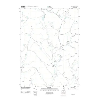
2013 Map of Andes
USGS Topo · Published 2013About this map
Andes serves as the central hub of this Catskill Mountain region, where the convergence of Tremper Kill and Liddle Brook historically shaped the village's development. The landscape is defined by its deep hollows and high points like Grays Mountain and Calhoun Hill, with a network of rural roads tracing the steep terrain. Long-established farmsteads such as Bush Creek Farm, Hemlock Springs Farm, and Tuttle Farm are scattered throughout, indicating the area's enduring agricultural character. Genealogists will find significant value in the distribution of local burial grounds, including the Andes Village Cem and several more secluded sites like Herr Cem and Shaver Hollow Road Cem. To the north, the waters of Lake Delaware and Silver Lake punctuate the upland forest, while the southern reaches are marked by the Arena Reservoir and the drainage of the Bush Kill.
Find a feature on this map
103 named features on this map. Tap any name to fly to it.
Don’t see what you’re looking for? This feature index may not catch every label — zoom into the map to look around manually.
Map Details
Editions of this 2013 Andes Map
This is the sole edition of this map. No revisions or reprints were ever made.
Other maps of this area

1901 · Margaretville
USGS Topo · 1:62,500

1904 · Hobart
USGS Topo · 1:62,500

1904 · Margaretville
USGS Topo · 1:62,500

1909 · Delhi
USGS Topo · 1:62,500

1911 · Delhi
USGS Topo · 1:62,500

1922 · Andes
USGS Topo · 1:62,500

1924 · Andes
USGS Topo · 1:62,500

1943 · Delhi
USGS Topo · 1:24,000

1943 · Bloomville
USGS Topo · 1:24,000
1945 · Arena
USGS Topo · 1:24,000