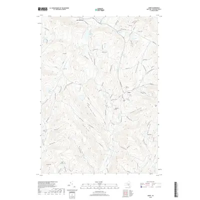
2019 Map of Andes
USGS Topo · Published 2019About this map
Andes serves as the primary hub in this portion of Delaware County, situated at the confluence of several prominent valleys. The settlement is flanked by numerous family and community burial grounds, including the Andes Rural Cemetery and the Andes Village Cemetery, alongside smaller sites like the Waterbury Cemetery and Herr Cemetery. This network of cemeteries provides significant touchpoints for genealogical research in an area defined by its complex drainage patterns. The Tremper Kill and Fiddle Brook feed into the regional waterway system, while the northern reaches are dominated by the waters of Lake Delaware and the Little Delaware River. The map illustrates a landscape of narrow hollows and high ridges, where routes like State Road Hollow and Gladstone Hollow dictate the placement of rural residences. To the south, the Bush Kill flows toward the Arena Reservoir, marking the transition into more mountainous terrain near Grays Mountain.
Find a feature on this map
101 named features on this map. Tap any name to fly to it.
Don’t see what you’re looking for? This feature index may not catch every label — zoom into the map to look around manually.
Map Details
Editions of this 2019 Andes Map
This is the sole edition of this map. No revisions or reprints were ever made.
Other maps of this area

1901 · Margaretville
USGS Topo · 1:62,500

1904 · Hobart
USGS Topo · 1:62,500

1904 · Margaretville
USGS Topo · 1:62,500

1909 · Delhi
USGS Topo · 1:62,500

1911 · Delhi
USGS Topo · 1:62,500

1922 · Andes
USGS Topo · 1:62,500

1924 · Andes
USGS Topo · 1:62,500

1943 · Delhi
USGS Topo · 1:24,000

1943 · Bloomville
USGS Topo · 1:24,000
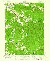
1945 · Arena
USGS Topo · 1:24,000