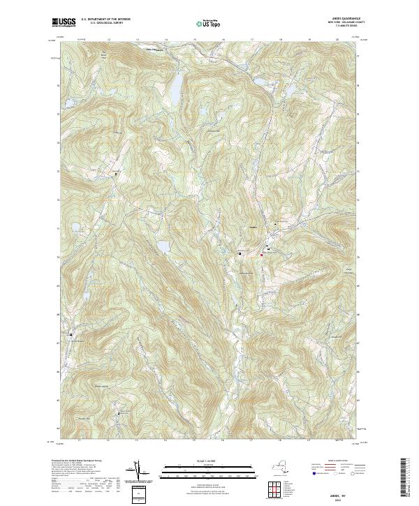
2023 Map of Andes
USGS Topo · Published 2023About this map
Andes serves as the central hub of this Catskill region, where the Tremper Kill and Liddle Brook meet. The settlement pattern is defined by deeply carved valleys or hollows, such as Gladstone Hollow and Wolf Hollow, which dictate the placement of historic farmsteads and cemeteries. Genealogists will find a high density of burial sites reflecting the area's early families, including Andes Rural Cemetery, the Herr Cemetery, and the Shaver Hollow Road Cemetery. To the south, the Arena Reservoir and Bush Kill drain the high terrain near Dingle Hill and Murphy Hill. The map also captures numerous water bodies like Lake Delaware and Tunis Lake, alongside distinctive geological features such as The Bullet Hole and the Hemlock Knoll landform, illustrating the complex drainage systems of Delaware County.
Find a feature on this map
103 named features on this map. Tap any name to fly to it.
Don’t see what you’re looking for? This feature index may not catch every label — zoom into the map to look around manually.
Map Details
Editions of this 2023 Andes Map
This is the sole edition of this map. No revisions or reprints were ever made.
Other maps of this area

1901 · Margaretville
USGS Topo · 1:62,500

1904 · Hobart
USGS Topo · 1:62,500

1904 · Margaretville
USGS Topo · 1:62,500

1909 · Delhi
USGS Topo · 1:62,500

1911 · Delhi
USGS Topo · 1:62,500

1922 · Andes
USGS Topo · 1:62,500

1924 · Andes
USGS Topo · 1:62,500

1943 · Delhi
USGS Topo · 1:24,000

1943 · Bloomville
USGS Topo · 1:24,000
1945 · Arena
USGS Topo · 1:24,000