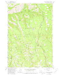
1963 Map of Andies Prairie
USGS Topo · Published 1980About this map
The high plateau and ridge country of Umatilla National Forest dominate this 1963 survey, where the border of Umatilla and Union counties follows the crest of high-elevation divides. Andies Prairie serves as a central landmark amidst a complex network of seasonal drainages and named ridges, including Ninemile Ridge and Phillips Ridge. The landscape is defined by its water sources, with numerous named springs such as Portuguese Spring, Will Rogers Spring, and Shamrock Spring providing vital points for forest management and local history. Transportation in this era relied on established routes like Skyline Road and Ruckel Road, while a Lookout Tower and Radio Facility indicate the region's importance for observation and communication. Recreational sites like the Woodland Park Campground and Picnic Spring reflect the mid-century development of the area for public use.
Find a feature on this map
41 named features on this map. Tap any name to fly to it.
Don’t see what you’re looking for? This feature index may not catch every label — zoom into the map to look around manually.
Map Details
Editions of this 1963 Andies Prairie Map
3 editions found
Other maps of this area

1953 · Pendleton
USGS Topo · 1:250,000

1955 · Grangeville
USGS Topo · 1:250,000

1956 · Pendleton
USGS Topo · 1:250,000

1959 · Grangeville
USGS Topo · 1:250,000

1963 · Andies Prairie
USGS Topo · 1:24,000

1963 · Sanderson Spring
USGS Topo · 1:24,000

1963 · Bingham Springs
USGS Topo · 1:24,000

1963 · Tollgate
USGS Topo · 1:24,000

1963 · Blalock Mountain
USGS Topo · 1:24,000

1964 · Partridge Creek
USGS Topo · 1:24,000