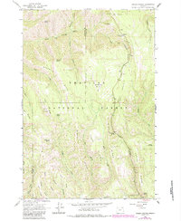
1963 Map of Andies Prairie
USGS Topo · Published 1984About this map
Umatilla National Forest defines this high-elevation landscape along the boundary of Umatilla and Union Counties. The terrain is characterized by a series of prominent basaltic ridges and narrow canyons, with the North Fork Umatilla River and the Middle Fork Little Umatilla River draining the northern and central reaches. Natural clearings like Andies Prairie and Horseshoe Prairie break the dense woodland, while dozens of named water sources—including English Spring, Shamrock Spring, and Will Rogers Spring—suggest the critical role of water management for forest operations and recreation in this era.
Find a feature on this map
40 named features on this map. Tap any name to fly to it.
Don’t see what you’re looking for? This feature index may not catch every label — zoom into the map to look around manually.
Map Details
Editions of this 1963 Andies Prairie Map
3 editions found
Other maps of this area

1953 · Pendleton
USGS Topo · 1:250,000

1955 · Grangeville
USGS Topo · 1:250,000

1956 · Pendleton
USGS Topo · 1:250,000

1959 · Grangeville
USGS Topo · 1:250,000

1963 · Andies Prairie
USGS Topo · 1:24,000

1963 · Sanderson Spring
USGS Topo · 1:24,000

1963 · Bingham Springs
USGS Topo · 1:24,000

1963 · Tollgate
USGS Topo · 1:24,000

1963 · Blalock Mountain
USGS Topo · 1:24,000

1964 · Partridge Creek
USGS Topo · 1:24,000