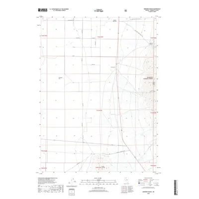
2018 Map of Andorno Ranch
USGS Topo · Published 2018About this map
Andorno Ranch sits at the eastern edge of a broad desert basin where the slopes of the Santa Rosa Range begin their ascent. This 2018 survey documents a remote landscape in Humboldt County defined by scattered water sources and rugged relief, with the Humboldt National Forest boundary marking the transition from the lowlands of Gallagher Flat to the higher elevations of the range. The name-history of the area is tied to these vital water points, including Cane Springs and the drainage of Andorno Creek.
Find a feature on this map
38 named features on this map. Tap any name to fly to it.
Don’t see what you’re looking for? This feature index may not catch every label — zoom into the map to look around manually.
Map Details
Editions of this 2018 Andorno Ranch Map
This is the sole edition of this map. No revisions or reprints were ever made.
Other maps of this area

1882 · Paradise
USGS Topo · 1:250,000

1893 · Paradise
USGS Topo · 1:250,000

1955 · McDermitt
USGS Topo · 1:250,000

1958 · Paradise Valley
USGS Topo · 1:62,500

1958 · Awakening Peak
USGS Topo · 1:62,500

1959 · McDermitt
USGS Topo · 1:250,000

1959 · Orovada
USGS Topo · 1:62,500

1959 · Hinkey Summit
USGS Topo · 1:62,500
1982 · Andorno Ranch
USGS Topo · 1:24,000
1982 · Gallagher Flat
USGS Topo · 1:24,000