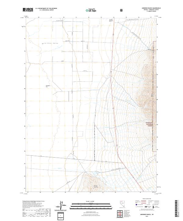
2021 Map of Andorno Ranch
USGS Topo · Published 2021About this map
Humboldt National Forest defines the eastern edge of this Humboldt County landscape, where the high elevations of the Santa Rosa Range descend toward the floor of the Quinn River Valley. The geography of the basin is marked by expansive level terrain such as Gallagher Flat, bisected by a grid of rural ranch roads including Old Miners Ranch Rd and Homestead Rd. In the southern portion of the sheet, the Bloody Run Hills rise above seasonal drainages like Tony Cr and Chimney Cr.
Find a feature on this map
39 named features on this map. Tap any name to fly to it.
Don’t see what you’re looking for? This feature index may not catch every label — zoom into the map to look around manually.
Map Details
Editions of this 2021 Andorno Ranch Map
This is the sole edition of this map. No revisions or reprints were ever made.
Other maps of this area

1882 · Paradise
USGS Topo · 1:250,000

1893 · Paradise
USGS Topo · 1:250,000

1955 · McDermitt
USGS Topo · 1:250,000

1958 · Paradise Valley
USGS Topo · 1:62,500

1958 · Awakening Peak
USGS Topo · 1:62,500

1959 · McDermitt
USGS Topo · 1:250,000

1959 · Orovada
USGS Topo · 1:62,500

1959 · Hinkey Summit
USGS Topo · 1:62,500
1982 · Andorno Ranch
USGS Topo · 1:24,000
1982 · Gallagher Flat
USGS Topo · 1:24,000