
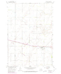
1958 Map of Andover
USGS Topo · Published 1960About this map
The town of Andover serves as the focal point of this 1958 survey, situated along the Chicago Milwaukee St Paul and Pacific railroad line. The map highlights the intersection of transportation and local history, documenting the presence of both the Andover Cem and All Saints Cem near the town center. The landscape is characterized by its agricultural townships, including Groton, Andover, and Hanson, with the Brown Co Day Co boundary line running through the western portion of the quadrangle. In the northeast, the presence of Mud L and a scattered Gravel Pit indicate the natural resource extraction and drainage patterns of the era. The mapping was completed as part of the Department of the Interior program for the development of the Missouri River Basin, providing a precise record of the region's infrastructure just before the turn of the decade.
Find a feature on this map
11 named features on this map. Tap any name to fly to it.
Don’t see what you’re looking for? This feature index may not catch every label — zoom into the map to look around manually.
Map Details
Editions of this 1958 Andover Map
2 editions found
Other maps of this area

1895 · Aberdeen
USGS Topo · 1:125,000

1896 · Columbia
USGS Topo · 1:125,000

1952 · Huffton
USGS Topo · 1:24,000

1953 · Milbank
USGS Topo · 1:250,000

1954 · Groton
USGS Topo · 1:24,000

1954 · Ferney
USGS Topo · 1:24,000

1954 · Aberdeen
USGS Topo · 1:250,000

1956 · Aberdeen
USGS Topo · 1:250,000

1958 · Milbank
USGS Topo · 1:250,000

1958 · Andover SW
USGS Topo · 1:24,000