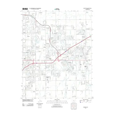
2012 Map of Andover
USGS Topo · Published 2012About this map
The city of Andover and the eastern fringes of Wichita are defined by a complex network of residential subdivisions and aviation infrastructure. This 2012 survey illustrates the rapid suburban development of the era, where established neighborhoods like Minneha and Lakeside Acres sit alongside sprawling industrial and private air facilities. The Beech Factory Airport and Colonel James Jabara Airport dominate the local landscape, reflecting the region's deep ties to the aerospace industry. Waterways such as Fourmile Creek and Republican Creek thread through the grids of newer developments like Greenwich Heights and Mecca Acres. For genealogists and local historians, several burial grounds are recorded, ranging from the large Kensington Gardens Memorial Centre to the small Deem Family Cemetery, alongside social landmarks like the Cedar Pines Municipal Golf Course.
Find a feature on this map
93 named features on this map. Tap any name to fly to it.
Don’t see what you’re looking for? This feature index may not catch every label — zoom into the map to look around manually.
Map Details
Editions of this 2012 Andover Map
This is the sole edition of this map. No revisions or reprints were ever made.
Other maps of this area

1889 · Wichita
USGS Topo · 1:125,000

1894 · Wichita
USGS Topo · 1:125,000

1941 · Valley Center
USGS Topo · 1:31,680

1942 · Valley Center
USGS Topo · 1:31,680

1943 · Wichita East
USGS Topo · 1:31,680

1943 · Derby
USGS Topo · 1:31,680

1945 · Andover
USGS Topo · 1:31,680

1955 · Santa Fe Lake
USGS Topo · 1:24,000

1955 · Benton
USGS Topo · 1:24,000

1955 · Greenwich
USGS Topo · 1:24,000