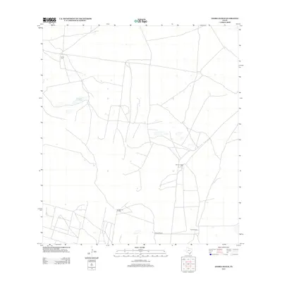
2013 Map of Andrea Ranch
USGS Topo · Published 2013About this map
Andrea Ranch and its surrounding pastoral landscape in Hidalgo County are defined by the vital water infrastructure necessary for South Texas ranching. This 2013 survey illustrates a network of roads and fencelines connecting isolated landmarks like the Stillman Loading Pens and several family-named water sources. The map records the functional layout of large-scale cattle operations through the placement of Puertas Verde Windmill, La Melona Windmill, and Copita Windmill. To the west, the ephemeral waters of Los Cayos de la Mula highlight the natural drainage patterns of this semi-arid region. The sparse distribution of named points suggests a landscape of significant acreage and quiet utility, where every named well and loading pen serves as a primary navigational and economic node for the local ranching community.
Find a feature on this map
6 named features on this map. Tap any name to fly to it.
Don’t see what you’re looking for? This feature index may not catch every label — zoom into the map to look around manually.
Map Details
Editions of this 2013 Andrea Ranch Map
This is the sole edition of this map. No revisions or reprints were ever made.
Other maps of this area

1922 · La Sal Vieja
USGS Topo · 1:62,500

1923 · Armstrong
USGS Topo · 1:62,500

1939 · Linn
USGS Topo · 1:62,500

1949 · Mc Allen
USGS Topo · 1:250,000

1953 · Brownsville
USGS Topo · 1:250,000

1954 · McAllen
USGS Topo · 1:250,000

1956 · Julian
USGS Topo · 1:24,000

1956 · Rudolph
USGS Topo · 1:24,000

1956 · Andrea Ranch
USGS Topo · 1:24,000

1956 · La Sal Vieja
USGS Topo · 1:24,000